Khasi Hills Community REDD+ Project
Te Ngāhere - The Forest
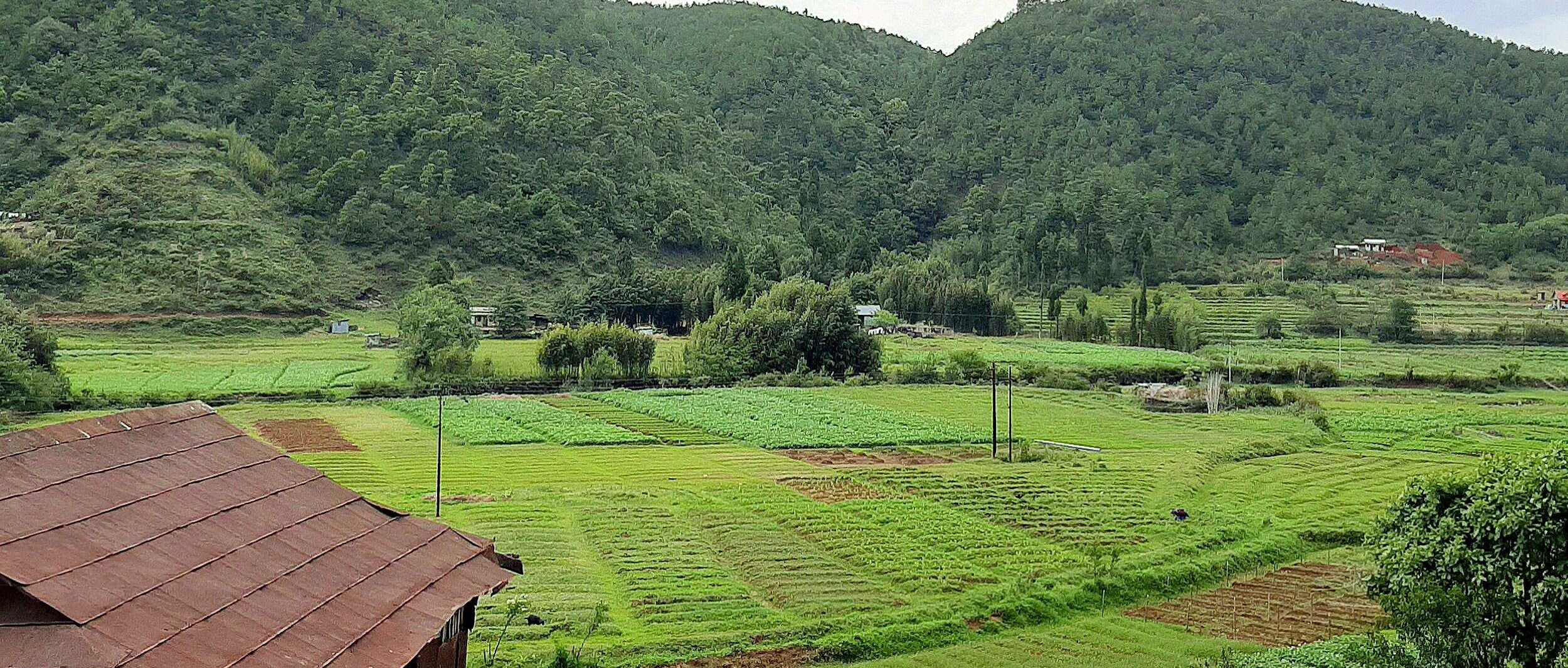
This project protects 27,178 hectares of temperate forest along the Umiam River in the East Khasi Hills District of Meghalaya, Northeast India.
Cyclonic air masses churning in the Bay of Bengal during the summer generate storms that slam into the Meghalaya Plateau that rises sharply from the flood plains of Bangladesh. These weather events create torrential monsoon rains that make the Khasi Hills one of the Earth’s rainiest places. Located between 150 and 2,000 meters the 27,178 hectare REDD+ project area is situated on a gently rolling plateau that slopes down steeply along the Umiam River.
This wet temperate forest is a unique habitat with impressive biodiversity, including 400 tree species, rare and abundant orchids, mushrooms, amphibians, and birds. Large mammals include bears, flying foxes, hoolock gibbons, tigers and the clouded leopard. Fauna includes dense forest of oaks, rhododendrons, chestnuts, alder, and figs, with its prolific variety of epiphytic growth including aroids, piper, ferns, and fern allies. The discovery of a new toad species (Odorana Mawphangensis) in a local sacred forest reflects the high biodiversity value of the area’s unique ecosystem.
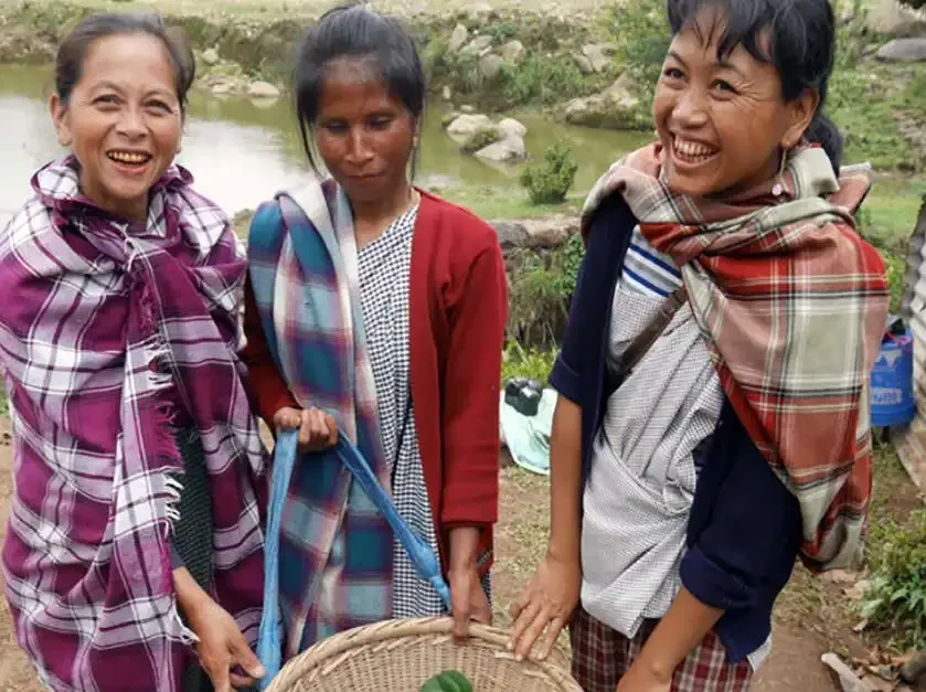
Te Tāngata - The People
In 2010, ten indigenous Khasi kingdoms of the Umiam watershed formed a United Federation or ‘Synjuk’ to manage and protect their shared watershed.
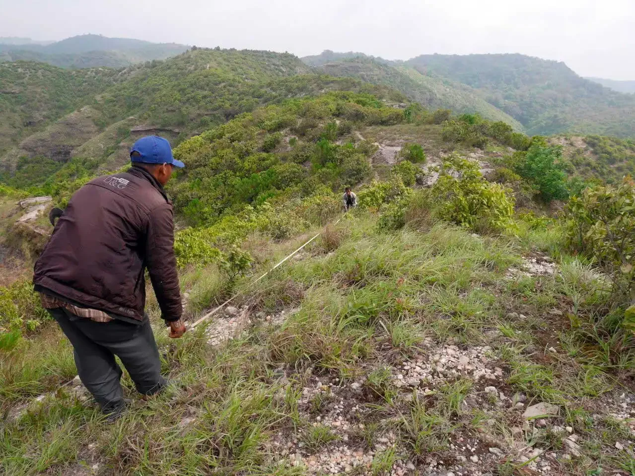
The small Khasi kingdoms situated on Meghalaya’s upland plateau have governed the land for centuries. Dozen’s of small hamlets are scattered across the rolling landscape. Khasi indigenous governments (hima) and village councils (dorbar) function as democratic institutions that manage society and the natural environment.
The Khasi peoples are matrilineal, with property rights transferred through the mother-line. This project represents a long-term strategy to address the poverty facing rural families by supporting sustainable resource management, new livelihood opportunities, and capitalising women-run micro-finance institutions. The decision to fund specifically women-run organisations is that the tendency is for them to spend their profits for the benefit of the whole community, funding health clinics, schools, and setting aside funds for emergencies. This decision has also been made on the basis of the UN’s SDG’s number 5 – ‘Gender Equality’.
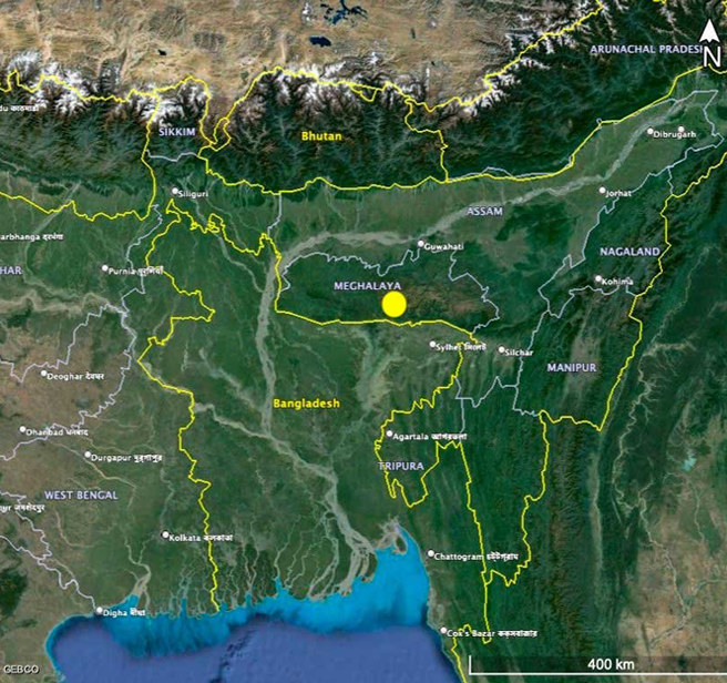
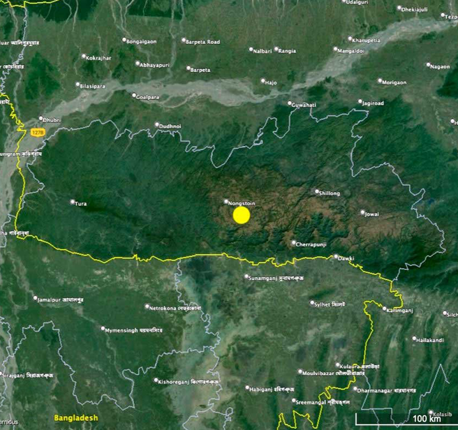
Khasi Hills Community REDD+ Project is located in North East India, along the Umiam River in the East Khasi Hills District of Meghalaya.
Wāhi - The Location
Technical Stuff
Reducing Emissions from Deforestation & Degradation (REDD+) and Assisted Natural Regeneration (ANR) are the two primary Plan Vivo project interventions covered in this project. In addition to REDD+ and ANR interventions, other income-generating activities (IGAs) are designed to improve local livelihoods. IGAs have been designed by the communities and are facilitated by the project team.
The project and its carbon offsets are certified to the Plan Vivo Standard – the world’s leading community-based, fair-trade styled forest carbon standard. Scroll down to access technical documents.
Khasi Hills Community REDD+ Project
Project Name
27,178 ha
Project Area
Rameka Forest Carbon Project
Project Owner
Project Developer
East Khasi Hills District of Meghalaya, India
Project Location
Continuation of periodic logging of indigenous forest
Baseline Scenario
Permanent forest protection
Project Scenario
Avoided deforestation & Assisted natural regeneration
Activity Type
Carbon sequestration; avoided carbon emissions; biodiversity conservation; water quality protection; climate resilience
Project Benefits
Not applicable
Trees Planted
410,678 tCO2e
Carbon Credits Issued
Carbon Credit Standard
Doug Baldwin
Verifier
Carbon Credit Registry
Project Partners
The project is one of the first REDD+ projects in Asia to be managed and implemented by indigenous communities (the Synjuk Federation), with support from Community Forestry International, the Khasi Hills Autonomous District Council, Planet Action, the Waterloo Foundation, Caring Friends, Tamborine Trust, and WeForest. The project is certified to the Plan Vivo Standard and is being audited every 5 years by Plan Vivo and/or Rainforest Alliance (carried out the audit in 2016-2017).